ArcGIS Online – New Collaborative Mapping Platform
What is ArcGIS Online?
ArcGIS online is a platform that allows BRA staff to visually display data through maps. Using the simple mapping interface you can use an ordinary web browser to access data from a variety of departments. This data can then be used to build interactive maps and applications created by staff that can be shared with the public, or embedded in websites, blogs, or social media sites. You will always be able to access this content whether you are using a desktop, browser, smart phone or tablet.
ArcGIS online was launched by the City of Boston in 2014. Because the platform is especially useful to supplement the work we do, especially in light of the recent Boston’s Citywide Master planning effort, the BRA is launching an ArcGIS Online site with specific groups and content that will support this effort and other BRA initiatives.
We have created groups such as: Transportation, Land Use and Zoning, Public Services, Economic Development and Business, Demographics, Environment and Housing. These groups content are completely customizable and can be edited and data added depending on the needs of staff.
Why should I use this site?
In ArcGIS Online you will be able to:
- Make a new Web map
- Learn how to map data in Microsoft Excel 2010
- Learn how to make a web application with a template
- Learn how to add content to a map
Data can be added from both City sources or other external sources then tagged appropriately. Spreadsheets with location data can be geocoded and interactive maps embedded in PowerPoint or other MS Office products.

How do I get started?
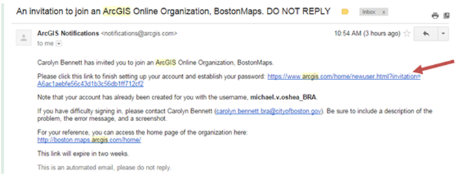
Look for an email/invite from ArcGIS Online that will have your login and temporary password information. To change your password follow instructions provided in the email. You will only have to do this one time.

How do I access ArcGIS Online after I have set up my account?
You can access ArcGIS online via the BRA Intranet:
Step 1
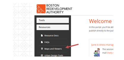
- Go to the BRA Intranet homepage and click Map and Viewers link under the Resources tab.

Step 2
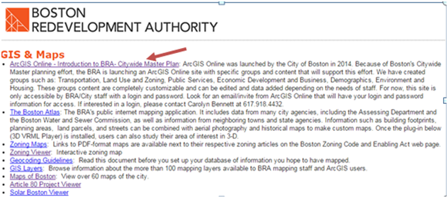
- Click the link labeled “ArcGIS Online”

Step 3
- Log in - You will be prompted to login ->Choose Using your ArcGIS Account -> login
(Note: You can also bookmark this link/URL to access the link directly)
Who can access the ArcGIS online?
For now, this site is only accessible by BRA/City staff with a login and password. Currently, accounts have only been created for the Planning Department for beta testing.
Who do I contact if I have any questions or feedback?
Please contact Carolyn Bennett, GIS Manager (carolyn.bennett@boston.gov or 617-918-4432)
What other mapping tools are available?
- BostonMaps: http://boston.maps.arcgis.com/home/index.html
- City of Boston Open Data Portal: http://bostonopendata.boston.opendata.arcgis.com/
Comments